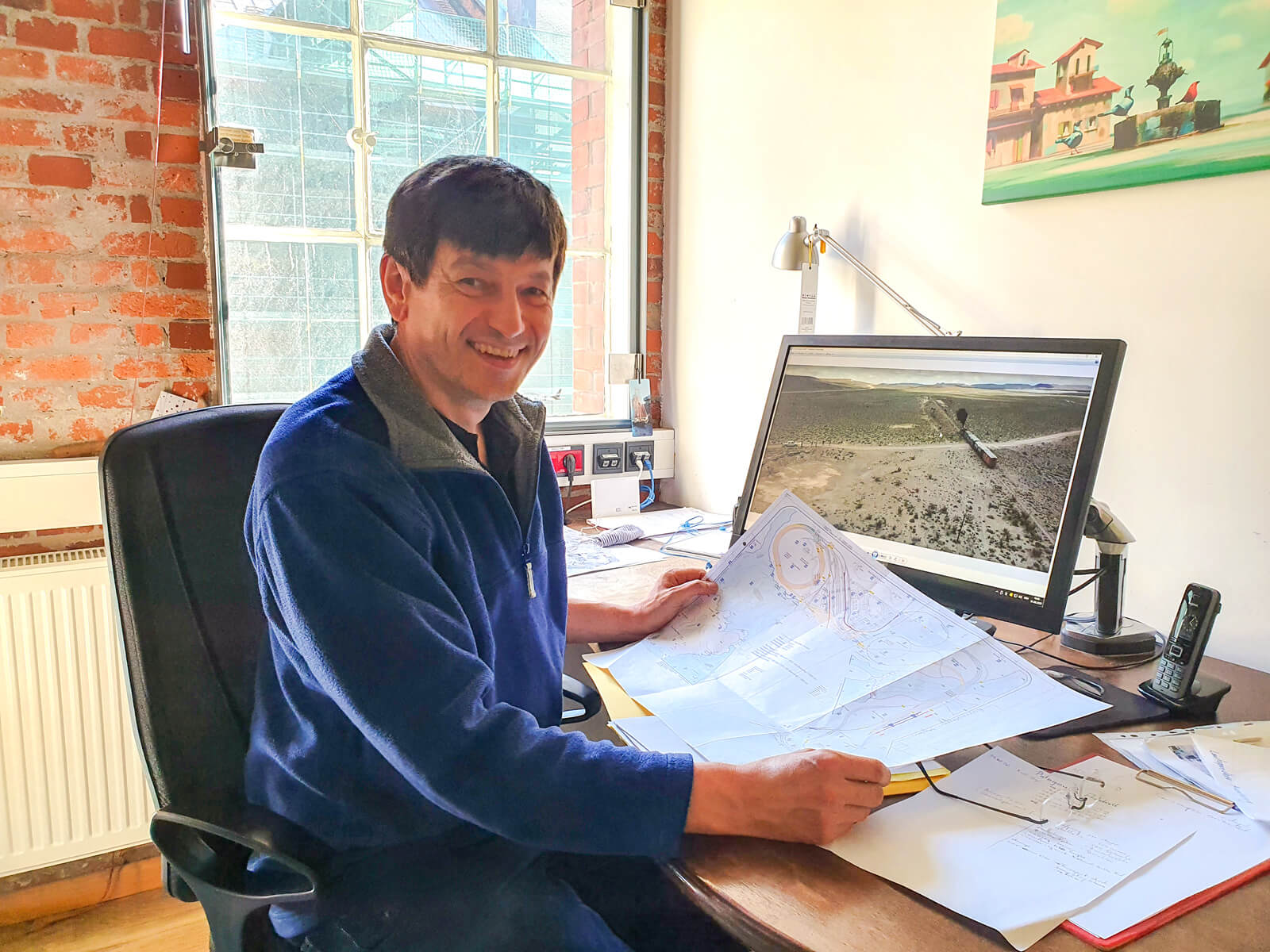
At the beginning of each new construction phase, model-making head Gerhard Dauscher disappears for a few days or even weeks in order to be able to fully concentrate on planning the new section. This cherished ritual could also be observed during the initial planning phase of the new Patagonia section. The result is an impressive vision of miniature Patagonia, which makes the excitement for the construction and of course for the new Wunderland addition grow immeasurably. We would like to share our Patagonia vision with you, too. So read for yourself what you can expect (hopefully from 2022 on) in the South America section of Miniatur Wunderland.
Patagonia, a journey to the end of the world.
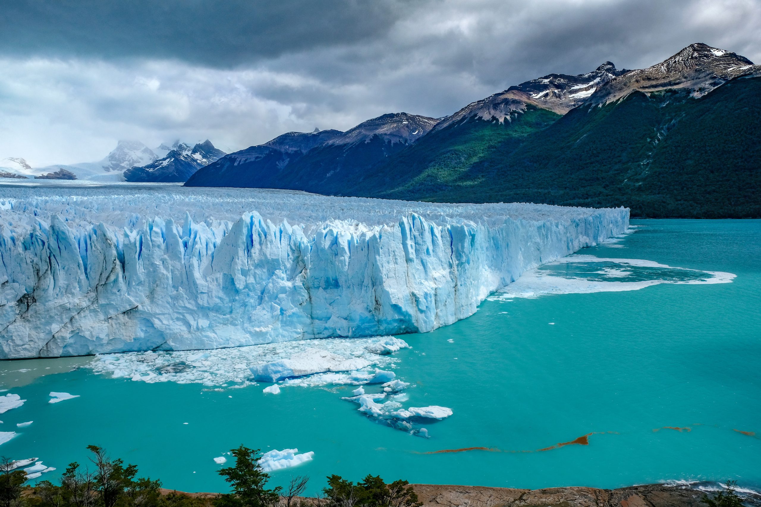
The steppe-like and barren plateau – better known as “pampa” – is the landscape that characterizes large parts of Patagonia. The modeling focus lies in the West Patagonian part and ends in the Andes with the most famous mountains Torres del Paine, Fitz Roy and Cerro Torre. The unique spectacle in the midst of the miniature mountain world is the calving glacier Perito Moreno, which pushes its ice chunks with loud roaring into a real water basin. The Argentinean part is located in the rain shadow of the Andes and is therefor very dry. A characteristic of this region is the constant strong wind. Typical representatives of the Patagonian fauna are the guanaco, the nandu and the Andean condor. The region is very sparsely populated. The indigenous population was pushed back by the white settlers. Until today courts argue who owns the land. Extensive sheep breeding and the hard business with wool is done by the Gauchos who often live under very simple conditions. Quite different are the owners of the so-called “Estancias”, who lead a comfortable life on – another reason for the social tension in this region.
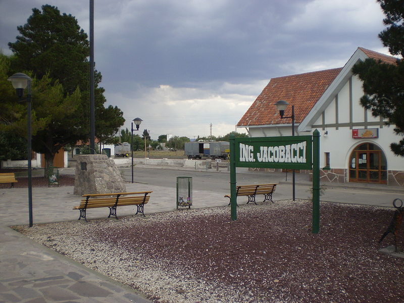
To connect the distant region more closely with the center of Buenos Aires, the railroad was the most important way of transportation. This made settlement and economic growth possible. Primarily agricultural products were transported. Frequently, coastal towns were connected with the hinterland in order to bring goods quickly to the market by rail and ship. Due to different investors and railroad engineers, a variety of railroad systems were created. In the center of our layout is the station “Ingeniero Jacobacci”. It is located on the single-track broad-gauge railroad (1667 mm) from Viedma to Bariloche which is served by the “Patagonia Express”. The special feature is a 750mm narrow gauge railroad, which branches off from the “Ingeniero Jacobacci” station and leads via El Maiten to Esquel to the foothills of the Andes. The route follows the hilly mountain landscape. The railroad lines themselves were not very artistically designed, which is why the train – pulled by a steam engine – makes its way through the steppe over many loops. In the station, a special loading ramp is used to load goods from broad gauge to narrow gauge. A railway triangle for turning the steam locomotives became necessary so that they can always “go forward” when changing direction. In the direction of the Andes, both gauges run on the so-called three-rail track. After 3 km the narrow gauge, also called “La Trochita”, turns south. Unfortunately, this railroad line has been on the shelf for a long time, which does not stop us from rebuilding it in its golden age. The background of our layout finishes flat and is continued as a mural to simulate an endless vastness. The village of Ingeniero Jacobacci is laid out in a checkerboard pattern and follows the course of the railroad tracks. Typical for this region, the cemetery is located far outside.
The peripheral region demands a great deal of improvisation skills from its inhabitants. Many everyday items are not always available. The trace of national economic developments can be seen in public space and in private everyday life.
Traces of subsidy programs and investments alternate with the consequences of recession. This can be seen, for example, on half-finished building sites, walls made of corrugated iron or a fence made of plastic foil.
The southernmost point is reached with Cape Horn, which can be seen as a coastal strip in the background. Here the visitor will feel fear and anxiety, as the stormy sea reaches for the blanks of the ships with the force of its roaring waves. Icebergs and ice shelves give a hint to the south pole. Since there is no railroad there, icebreakers and penguins will make sure there is movement. In a niche you can discover the world under the Arctic Ocean.
